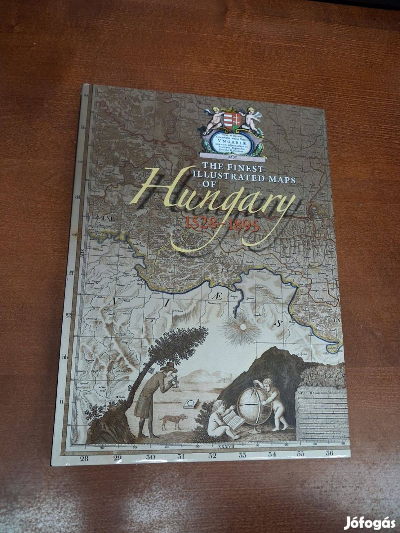
Plihál Katalin - The Finest Illustrated Maps of Hungary 1528-1895
4 990
FtKategória:
Feladás dátuma:
több, mint egy hónapjaTulajdonságok
alig használt
Történelem
Keménytáblás
Angol
Leírás
Az angol nyelvű album megkímélt, új állapotban van.
Maps are true reflections of history. They offer snapshots of conditions in the region they deal with at a given moment. The present volume invites the readers for a journey in time by means of early and more recent maps preserved in the National Széchényi Library. The journey begins with the Tabula Hungariae published in 1528, the most beautifully executed map of a country in the first half of the 16th century, and the richest in geographical content that became a UNESCO-protected cultural treasure in 2007. Then come maps from the period of the Turkish occupation, maps of castles and sieges, and finally ones made after the expulsion of the Turks. We take excursions also in 18th-century Transylvania, and in Southeastern Europe, as well. Some maps in the volume present contemporary Hungarian costumes, inform us about the distribution of the nationalities, or give an overview of Franciscan monasteries in the country. They offer a peculiar insight into political and military events considered important at the time of their making, which makes the book an unparallelled selection in its kind. These maps are geographic masterpieces and enrapturing pieces of art at the same time.....
Hasonló hirdetések

Ez is érdekelhet
Jófogás mobil applikáció

Töltsd le alkalmazásunkat!
Keress és válogass közel másfélmillió hirdetés közül bárhol is vagy!
A Jófogást megtalálod a közösségi oldalakon is!
Keresett márkák
trabant
mini cooper
jbl
forza horizon 4
nintendo switch
samsung galaxy s10
lego friends
xbox one
husqvarna
mayo chix
iphone 11
iphone se
xiaomi mi 10
ps5
bonprix
bershka
tchibo
honfoglaló
kika
cropp
xiaomi redmi note 9 pro
miután
brawl stars
xbox series x
crystal nails
amerikai staffordshire terrier
iphone 11 pro
airpods
samsung tv
playstation 5
gamestar
iphone xr
apple watch
huawei p30 lite
samsung galaxy a51
iphone x
labrador
iphone 6s
husky
maine coon
ps4
iphone 7
iphone xs
ipad
iphone 8
Népszerű kategóriák
eladó lakás
monitor
téli gumi
ingyen elvihető
trambulin
elektromos roller
mosogatógép
puzzle
eladó lovak
laptop
eladó ház
okosóra
francia bulldog
használt autó
számológép
szinoníma szótár
konyhabútor
sakk
szájmaszk
halloween tök
mikrohullámú sütő
trapézlemez
adventi koszorú
elektromos kerékpár
kerti bútor
térkő
kávéfőző
számítógép
menyasszonyi ruha
futópad
gördeszka
tolóajtó
bluetooth fülhallgató
könnyűszerkezetes ház
dohányzóasztal
bejárati ajtó
kanapéágy
hintaágy
bicikli
diego szőnyeg
használt laptop
faház
hdmi kábel
aroma diffúzor
gáztűzhely
roller
tengerimalac
magaságyás
függőfotel